德舒特河
外观
| 德舒特河 Deschutes River | |
|---|---|
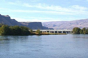
 距离河口处不远的德舒特河。 | |
 德舒特河流域图 | |
德舒特河河口在俄勒冈州和美国的位置 | |
| 词源 | From Rivière des Chutes, used by early-19th-century fur traders[2] |
| 国家 | |
| 州 | |
| 县 | 德舒特县、杰佛逊县、 谢尔曼县、沃斯科县 |
| 流域 | |
| 源头 | 小熔岩湖 |
| • 位置 | 喀斯喀特山脉 |
| • 坐标 | 43°54′33″N 121°45′40″W / 43.90917°N 121.76111°W[1] |
| • 海拔 | 4,747英尺(1,447米)[3] |
| 河口 | 哥伦比亚河 |
| • 位置 | 谢尔曼县和沃斯科县交界处,费尔班克斯和比格斯章克申之间 |
| • 坐标 | 45°38′07″N 120°54′52″W / 45.63528°N 120.91444°W[1] |
| • 海拔 | 164英尺(50米)[1] |
| 流域面积 | 10,500 sq mi(27,000 km2)[4] |
| 本貌 | |
| 长度 | 252 mi(406 km)[5] |
| 流量 | |
| • 地点 | Moody,距离河口1.4英里(2.3千米)[4][6] |
| • 平均流量 | 5,824 cu ft/s(164.9 m3/s)[4][6] |
| • 最小流量 | 2,400 cu ft/s(68 m3/s) |
| • 最大流量 | 70,300 cu ft/s(1,990 m3/s) |
无效指定 | |
| 类型 | Scenic, Recreational |
| 评定时间 | 1988年10月28日 |
德舒特河(英语:Deschutes River,/dəˈʃuːts/ )是俄勒冈州中部的一条河流,是哥伦比亚河的一条主要支流,全长406km,起源于小熔岩湖,汇集了喀斯喀特山脉东坡的许多河流,在俄勒冈州与华盛顿州的边界注入哥伦比亚河。
参考文献
[编辑]- ^ 1.0 1.1 1.2 Deschutes River. Geographic Names Information System (GNIS). United States Geological Survey (USGS). November 28, 1980 [October 13, 2008].
- ^ McArthur, Lewis A.; McArthur, Lewis L. Oregon Geographic Names, Seventh Edition. Portland, Oregon: Oregon Historical Society Press. 2003: 282–83. ISBN 0-87595-277-1.
- ^ Source elevation derived from Google Earth search using GNIS source coordinates.
- ^ 4.0 4.1 4.2 Water-Data Report 2013: 14103000 Deschutes River at Moody, Near Biggs, OR (PDF). United States Geological Survey. 2014 [September 25, 2014]. (原始内容存档 (PDF)于2020-09-18).
- ^ Online Topographic Maps from the United States Geological Survey. TopoQuest. [October 13, 2008]. (原始内容存档于2012-09-25).
- ^ 6.0 6.1 The average discharge rate was calculated from USGS records from the Moody gauge of water years 1898–99 and 1907–2013.


