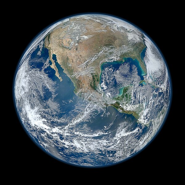
File:North America from low orbiting satellite Suomi NPP.jpg
外观

本预览的尺寸:600 × 600像素。 其他分辨率:240 × 240像素 | 480 × 480像素 | 768 × 768像素 | 1,024 × 1,024像素 | 2,048 × 2,048像素 | 8,000 × 8,000像素。
原始文件 (8,000 × 8,000像素,文件大小:16.43 MB,MIME类型:image/jpeg)
文件历史
点击某个日期/时间查看对应时刻的文件。
| 日期/时间 | 缩略图 | 大小 | 用户 | 备注 | |
|---|---|---|---|---|---|
| 当前 | 2012年1月26日 (四) 04:03 |  | 8,000 × 8,000(16.43 MB) | Hellbus | {{Information |Description ={{en|1=A 'Blue Marble' image of the Earth taken from the VIIRS instrument aboard NASA's most recently launched Earth-observing satellite - Suomi NPP. This composite image uses a number of swaths of the Earth's surface taken |
文件用途
以下4个页面使用本文件:
全域文件用途
以下其他wiki使用此文件:
- af.wikipedia.org上的用途
- ar.wikipedia.org上的用途
- as.wikipedia.org上的用途
- az.wikiquote.org上的用途
- be-tarask.wikipedia.org上的用途
- bn.wikipedia.org上的用途
- crh.wikipedia.org上的用途
- cv.wikipedia.org上的用途
- de.wikipedia.org上的用途
- el.wikipedia.org上的用途
- en.wikipedia.org上的用途
- The Blue Marble
- Portal:Energy
- Portal:Energy/Energy topics
- User:Northamerica1000
- Portal:Society/Featured article
- User talk:Semccraw
- User talk:Jesusserrano
- User talk:Bmbrooks
- User talk:Bhaluska
- User talk:Ependell
- User talk:Mmutterperl
- User talk:Kaylaek
- User talk:Tjohns17
- User talk:BellaBeast
- User talk:JessicaSG
- User talk:Laurenm2
- User talk:Jessgutman
- User talk:Lissyh1990
- User talk:Maxsasaki
- User talk:Aebarone
- User talk:Emackin
- User talk:Lmfye
- User talk:EauroraUA
- User talk:Jaallen1
- User talk:Dkunst
- User talk:Girg45
- User talk:Cindyy1
- User talk:Aglick
- Suomi NPP
- User:Cullen328/Welcome
- Wikipedia:Featured picture candidates/February-2012
- User talk:Sdmuszyn
- User talk:Allieglock
- User talk:Cpatel623
- User talk:Darrinbrink
查看此文件的更多全域用途。


