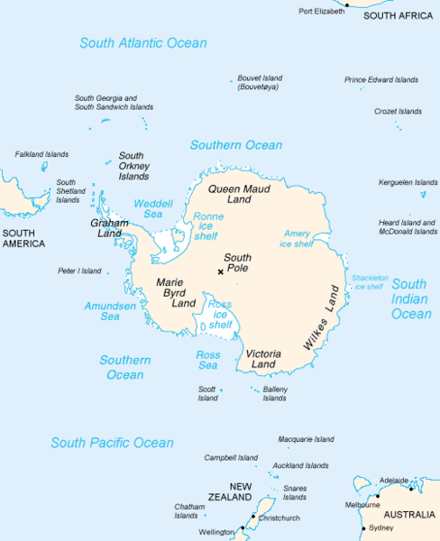
File:Antarctica Map.png
外观

本预览的尺寸:488 × 600像素。 其他分辨率:195 × 240像素 | 502 × 617像素。
原始文件 (502 × 617像素,文件大小:52 KB,MIME类型:image/png)
文件历史
点击某个日期/时间查看对应时刻的文件。
| 日期/时间 | 缩略图 | 大小 | 用户 | 备注 | |
|---|---|---|---|---|---|
| 当前 | 2004年12月15日 (三) 23:16 |  | 502 × 617(52 KB) | Mschlindwein |
文件用途
全域文件用途
以下其他wiki使用此文件:
- an.wikipedia.org上的用途
- ar.wikipedia.org上的用途
- avk.wikipedia.org上的用途
- azb.wikipedia.org上的用途
- be.wikipedia.org上的用途
- bjn.wikipedia.org上的用途
- blk.wikipedia.org上的用途
- bn.wikipedia.org上的用途
- br.wikipedia.org上的用途
- bs.wikipedia.org上的用途
- ca.wikipedia.org上的用途
- cs.wikipedia.org上的用途
- da.wikipedia.org上的用途
- de.wikinews.org上的用途
- en.wikipedia.org上的用途
- Filchner–Ronne Ice Shelf
- Frost Glacier
- Second German Antarctic Expedition
- Totten Glacier
- Wikipedia:WikiProject Antarctica
- Polynesian navigation
- Underwood Glacier
- Farthest South
- Adams Glacier (Wilkes Land)
- Ocean fisheries
- 80th parallel south
- Southern Ocean
- Dibble Iceberg Tongue
- Gilchrist Glacier
- Peterson Glacier
- Bell Glacier
- Blair Glacier
- Blodgett Iceberg Tongue
- Bond Glacier
- Bibliography of Antarctica
- Conger Glacier
- Waldron Glacier
- Whittle Glacier
- De Haven Glacier
查看此文件的更多全域用途。


