
File:China’s Critical Sea Lines of Communication.png
預覽大小:730 × 599 像素。 其他解析度:292 × 240 像素 | 585 × 480 像素 | 935 × 768 像素 | 1,046 × 859 像素。
原始檔案 (1,046 × 859 像素,檔案大小:292 KB,MIME 類型:image/png)
| 描述 |
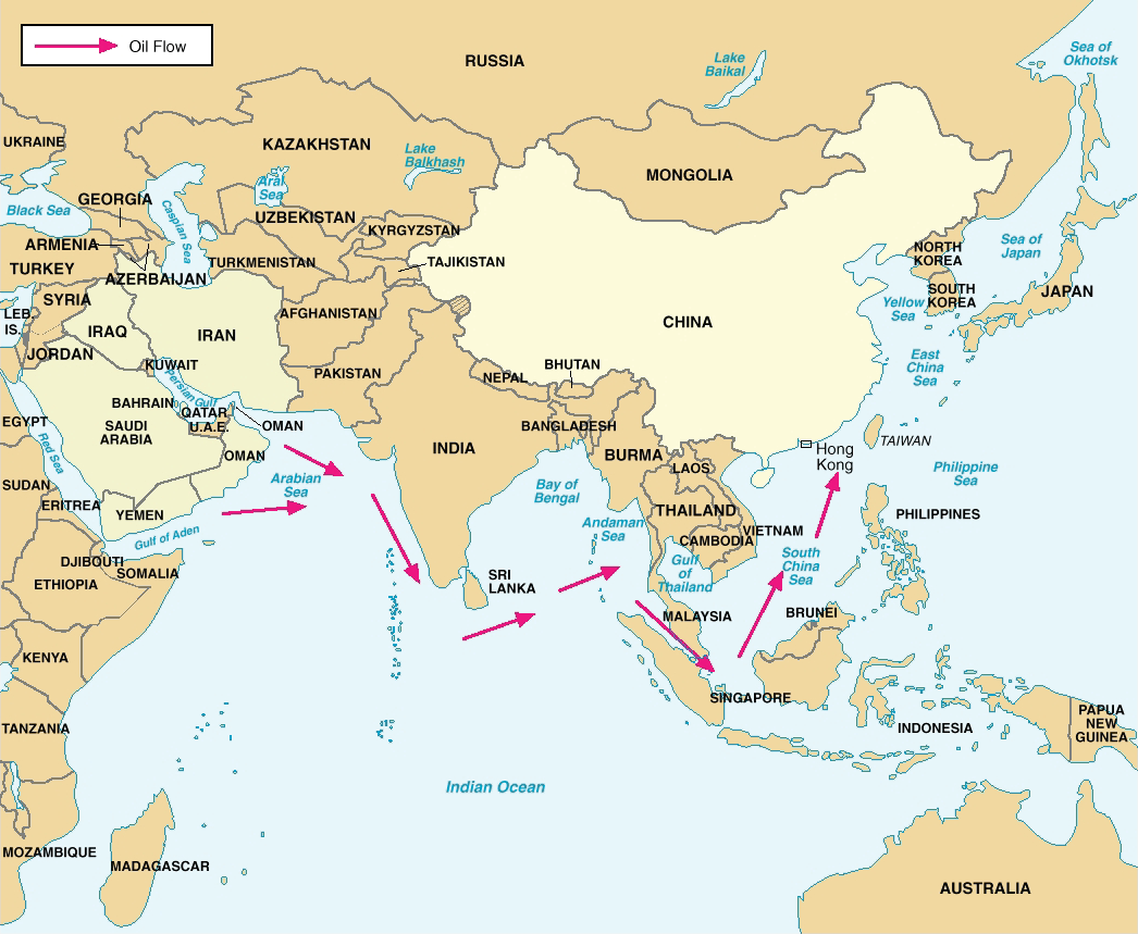
Figure 8. China’s Critical Sea Lines of Communication. Note: In 2004, over 80 percent of Chinese crude oil imports transited the Straits of Malacca, with less than 2 percent transiting the Straits of Lombok. Deutsch: Chinas wichtigste Ölversorgungswege auf See |
|||
| 日期 | 05/23/06 | |||
| 來源 | Image:China Report 2006.pdf; China Report 2006 [1] (PDF, 58 S., 1,42 MB) | |||
| 作者 | DoD | |||
| 授權許可 (重用此檔案) |
|

檔案歷史
點選日期/時間以檢視該時間的檔案版本。
| 日期/時間 | 縮圖 | 尺寸 | 用戶 | 備註 | |
|---|---|---|---|---|---|
| 目前 | 2018年3月8日 (四) 14:17 | | 1,046 × 859(292 KB) | Ras67 | new extracted and cropped from PDF |
| 2016年2月20日 (六) 22:28 |  | 1,045 × 735(220 KB) | Mahahahaneapneap | Cropped | |
| 2006年5月26日 (五) 08:42 |  | 1,072 × 778(311 KB) | Shizhao | {{Information |Description=Figure 8. China’s Critical Sea Lines of Communication. Note: In 2004, over 80 percent of Chinese crude oil imports transited the Straits of Malacca, with less than 2 percent transiting the Straits of Lombok. |Source=[[:Image: |
檔案用途
全域檔案使用狀況
以下其他 wiki 使用了這個檔案:
- de.wikipedia.org 的使用狀況
- en.wikipedia.org 的使用狀況
- es.wikipedia.org 的使用狀況
- fr.wikipedia.org 的使用狀況
- it.wikipedia.org 的使用狀況
- ja.wikipedia.org 的使用狀況
- ko.wikipedia.org 的使用狀況
- ms.wikipedia.org 的使用狀況
- nl.wikipedia.org 的使用狀況
- pt.wikipedia.org 的使用狀況
- sl.wikipedia.org 的使用狀況
- ta.wikipedia.org 的使用狀況
- th.wikipedia.org 的使用狀況
- tr.wikipedia.org 的使用狀況
- uk.wikipedia.org 的使用狀況
- www.wikidata.org 的使用狀況