
File:Rabideau Civilian Conservation Corps Camp, Picnic Shelter.jpg
預覽大小:760 × 600 像素。 其他解析度:304 × 240 像素 | 608 × 480 像素 | 973 × 768 像素 | 1,280 × 1,010 像素 | 2,560 × 2,021 像素 | 4,666 × 3,683 像素。
原始檔案 (4,666 × 3,683 像素,檔案大小:4.82 MB,MIME 類型:image/jpeg)
| 描述 |
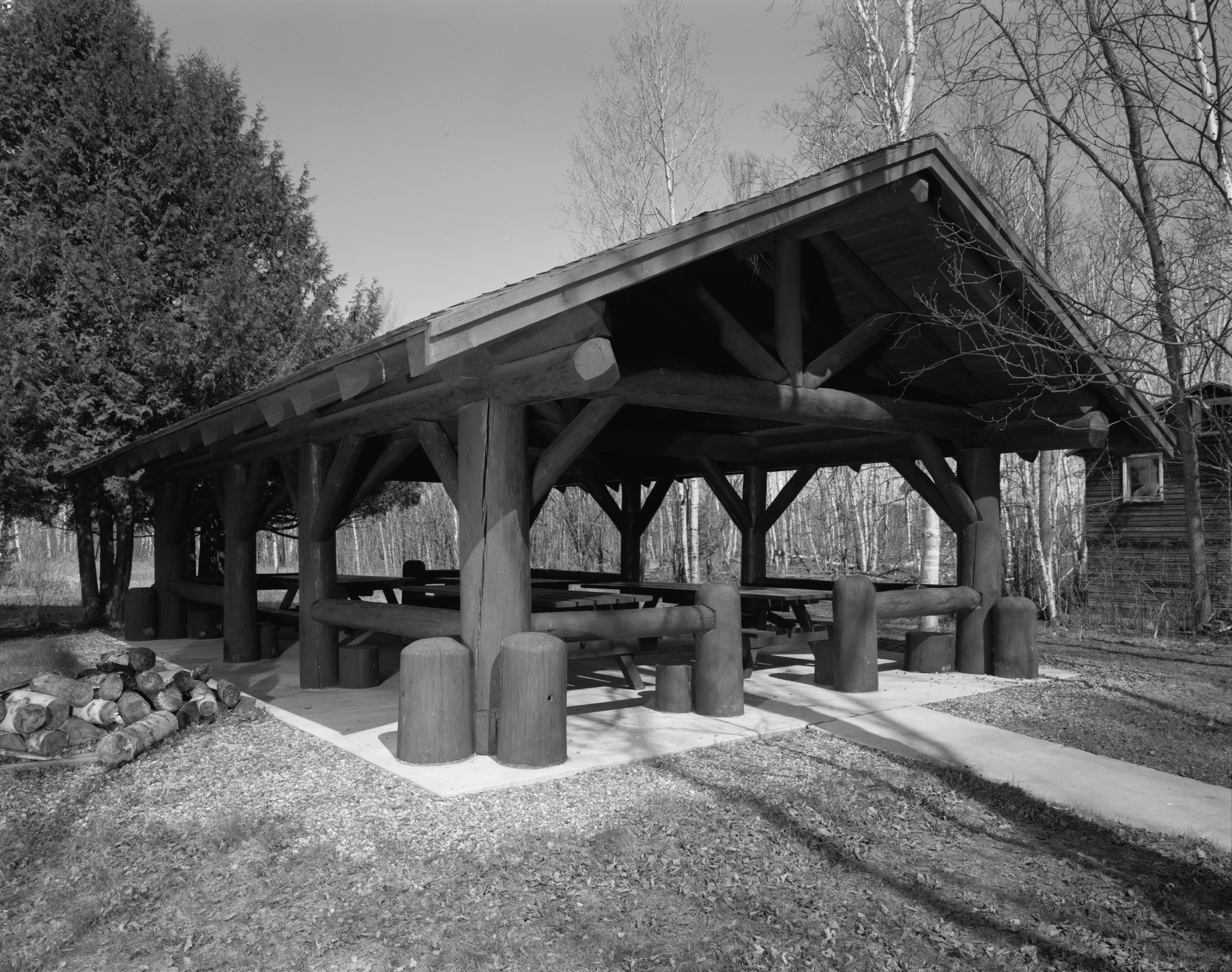
English: Rabideau Civilian Conservation Corps Camp, Picnic Shelter, County Road 39, Blackduck vicinity, Beltrami County, MN. Originally constructed by the Civilian Conservation Corps at another site in Minnesota, the Picnic Shelter was moved to the Rabideau Camp by the U.S. Forest Service in 1986. It is architecturally significant as an example of the finely crafted, labor-intensive log construction built throughout Minnesota's state parks and national forests during the Depression Era. |
||
| 日期 | 2007年11月2日 (原始上傳日期) | ||
| 來源 |
|
||
| 作者 | 原上傳者為英文維基百科的Appraiser |

| 目標地點 | | 位於此地的本圖片與其他圖片: OpenStreetMap |
|---|
授權條款

|
This file comes from the Historic American Buildings Survey (HABS), Historic American Engineering Record (HAER) or Historic American Landscapes Survey (HALS). These are programs of the National Park Service established for the purpose of documenting historic places. Records consist of measured drawings, archival photographs, and written reports.
|
| This image or media file contains material based on a work of a National Park Service employee, created as part of that person's official duties. As a work of the U.S. federal government, such work is in the public domain in the United States. See the NPS website and NPS copyright policy for more information. |
原始上傳日誌
The original description page was here. All following user names refer to en.wikipedia.
- 2007-11-02 20:16 Appraiser 1024×822×8 (177566 bytes) {{HABS}} [http://memory.loc.gov/cgi-bin/query/S?pp/hh:@field(SUBJ+@od1(MINNESOTA--Beltrami+County--Blackduck+vicinity))] [[Category:Images of Minnesota]]
原始上傳日誌
| date/time | username | resolution | size | edit summary |
|---|---|---|---|---|
| 2009-09-10T17:37:58Z | User:Yann | 4666×3683 | 4.82Gb | full size |
| 2008-04-05T08:41:38Z | User:Finavon | 958×753 | 159.01Kb | border cropped |
| 2008-02-18T22:53:50Z | User:Matthiasb | 1024×822 | 173.4Kb | {{Information |Description={{en|[http://memory.loc.gov/cgi-bin/query/S?pp/hh:@field(SUBJ+@od1(MINNESOTA--Beltrami+County--Blackduck+vicinity))] [[:en:Category:Images of Minnesota]]}} |Source=Transferred from [http://en.wikipedia.org en.wikipedia] |Date=20 |
檔案歷史
點選日期/時間以檢視該時間的檔案版本。
| 日期/時間 | 縮圖 | 尺寸 | 使用者 | 備註 | |
|---|---|---|---|---|---|
| 目前 | 2009年9月13日 (日) 02:01 | | 4,666 × 3,683(4.82 MB) | BetacommandBot | move approved by: User:Yann This image was moved from File:Rabideau.jpg {{Information |Description={{en|Rabideau Civilian Conservation Corps Camp, Picnic Shelter, County Road 39, Blackduck vicinity, Beltrami County, MN. Originally constructed |
檔案用途
下列頁面有用到此檔案:
全域檔案使用狀況
以下其他 wiki 使用了這個檔案:
- de.wikipedia.org 的使用狀況
- en.wikipedia.org 的使用狀況
- es.wikipedia.org 的使用狀況
- ru.wikipedia.org 的使用狀況
- ur.wikipedia.org 的使用狀況
- vi.wikipedia.org 的使用狀況
- www.wikidata.org 的使用狀況