
File:Meyers Geographischer Handatlas 1912-Tsingtau.jpg
本预览的尺寸:465 × 599像素。 其他分辨率:186 × 240像素 | 372 × 480像素 | 596 × 768像素 | 794 × 1,024像素 | 1,589 × 2,048像素 | 4,131 × 5,325像素。
原始文件 (4,131 × 5,325像素,文件大小:10.33 MB,MIME类型:image/jpeg)
摘要
| 描述 |
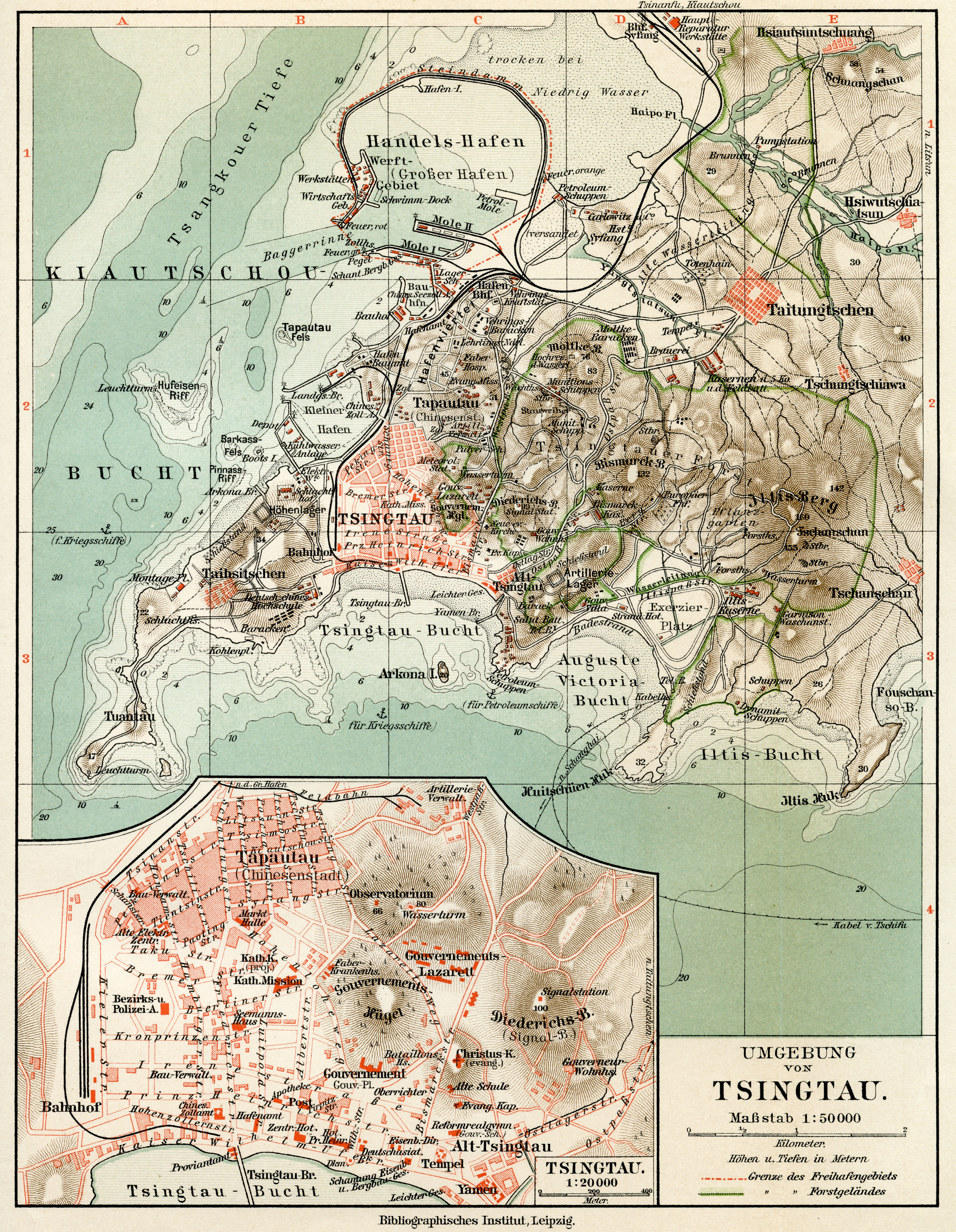
English: Map of German colony of Tsingtau, 1912
Deutsch: Karte der deutschen Kolonie Tsingtau, 1912 |
||||
| 日期 | (Scan) | ||||
| 来源 | Meyers Geographischer Handatlas, Leipzig/Wien, 4th ed. 1912 | ||||
| 作者 | Till Niermann | ||||
| 授权 (二次使用本文件) |
|
||||
文件历史
点击某个日期/时间查看对应时刻的文件。
| 日期/时间 | 缩略图 | 大小 | 用户 | 备注 | |
|---|---|---|---|---|---|
| 当前 | 2022年9月14日 (三) 16:21 | | 4,131 × 5,325(10.33 MB) | Till.niermann | Reverted to version as of 17:19, 13 June 2010 (UTC) |
| 2022年9月10日 (六) 07:31 |  | 4,131 × 5,325(9.65 MB) | 1970gemini | endschleiart | |
| 2010年6月13日 (日) 17:19 |  | 4,131 × 5,325(10.33 MB) | Till.niermann | {{Information |Description={{en|1=Map of German colony of Tsingtau, 1912}} {{de|1=Karte der deutschen Kolonie Tsingtau, 1912}} |Source=Meyers Geographischer Handatlas, Leipzig/Wien, 4th ed. 1912 |Author=Till Niermann |Date=2010-06-1 |
文件用途
以下页面使用本文件:
全域文件用途
以下其他wiki使用此文件:
- da.wikipedia.org上的用途
- de.wikipedia.org上的用途
- fr.wikipedia.org上的用途