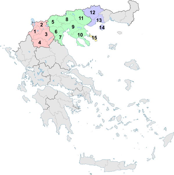
File:Greek Macedonia map with subdivisions.svg
外观

此SVG文件的PNG预览的大小:599 × 600像素。 其他分辨率:240 × 240像素 | 479 × 480像素 | 767 × 768像素 | 1,023 × 1,024像素 | 2,045 × 2,048像素 | 736 × 737像素。
原始文件 (SVG文件,尺寸为736 × 737像素,文件大小:1.78 MB)
文件历史
点击某个日期/时间查看对应时刻的文件。
| 日期/时间 | 缩略图 | 大小 | 用户 | 备注 | |
|---|---|---|---|---|---|
| 当前 | 2019年2月10日 (日) 14:24 |  | 736 × 737(1.78 MB) | Sarah fides | Hopefully this fixes the annoying black line that keeps appearing off the Ionian islands |
| 2019年2月10日 (日) 14:21 |  | 736 × 737(1.79 MB) | Sarah fides | Cleanup | |
| 2011年7月27日 (三) 22:25 |  | 7,304 × 7,315(1.79 MB) | Sarah fides | {{Information |Description={{en|1=The Greek region of Macedonia, and its subdivisions into Peripheries and Peripheral Units as of 2011.}} |Source=*File:Greece_2011_Periferiakes_Enotites.svg |Date=2011-07-27 22:23 (UTC) |Author=*[[:File:Greece_2011_P |
文件用途
没有页面使用本文件。
全域文件用途
以下其他wiki使用此文件:
- de.wikipedia.org上的用途
- el.wikipedia.org上的用途
- el.wikivoyage.org上的用途
- en.wikipedia.org上的用途
- et.wikipedia.org上的用途
- fi.wikipedia.org上的用途
- fr.wikivoyage.org上的用途
- hr.wikipedia.org上的用途
- lt.wikipedia.org上的用途
- nn.wikipedia.org上的用途
- vi.wikipedia.org上的用途

