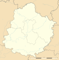
File:Sarthe department relief location map.jpg
外观

本预览的尺寸:591 × 599像素。 其他分辨率:237 × 240像素 | 474 × 480像素 | 758 × 768像素 | 1,179 × 1,195像素。
原始文件 (1,179 × 1,195像素,文件大小:250 KB,MIME类型:image/jpeg)
文件历史
点击某个日期/时间查看对应时刻的文件。
| 日期/时间 | 缩略图 | 大小 | 用户 | 备注 | |
|---|---|---|---|---|---|
| 当前 | 2011年3月12日 (六) 22:34 |  | 1,179 × 1,195(250 KB) | Sting | == {{int:filedesc}} == {{Information |Description={{en|Blank physical map of the department of Sarthe, France, as in February 2011, for geo-location purpose, with distinct boundaries for regions, departments and arrondissements.}} {{fr|Cart |
文件用途
以下页面使用本文件:
全域文件用途
以下其他wiki使用此文件:
- als.wikipedia.org上的用途
- de.wikipedia.org上的用途
- eo.wikipedia.org上的用途
- 24 Horoj de Manso
- Le Mans
- Ŝablono:Situo sur mapo Francio Sarthe
- Sablé-sur-Sarthe
- Mamers
- Courgenard
- La Ferté-Bernard
- Saint-Calais
- Sillé-le-Guillaume
- Allonnes (Sarthe)
- Arçonnay
- Arnage
- Champfleur
- La Chapelle-Saint-Aubin
- Coulaines
- Mulsanne
- Saint-Paterne - Le Chevain
- Montval-sur-Loir
- Beaumont-sur-Sarthe
- Montbizot
- Crissé
- Champagné
- Conlie
- Aubigné-Racan
- Domfront-en-Champagne
- La Guierche
- Fresnay-sur-Sarthe
- La Suze-sur-Sarthe
- Connerré
- Beillé
- Voivres-lès-le-Mans
- Vaas
- Rouessé-Vassé
- Saint-Mars-la-Brière
- Sceaux-sur-Huisne
- Boëssé-le-Sec
- Noyen-sur-Sarthe
- Mayet
- Laigné-en-Belin
- Saint-Gervais-en-Belin
- La Chartre-sur-le-Loir
- Bessé-sur-Braye
- Saint-Brice (Mayenne)
- Souvigné-sur-Sarthe
- Saint-Denis-d'Anjou
- Pincé
- Courtillers
查看此文件的更多全域用途。


