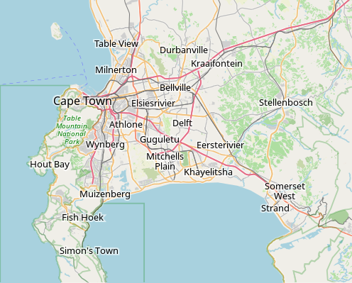
File:OpenStreetMap Cape Town small.svg
外观

此SVG文件的PNG预览的大小:496 × 399像素。 其他分辨率:298 × 240像素 | 597 × 480像素 | 955 × 768像素 | 1,273 × 1,024像素 | 2,546 × 2,048像素。
原始文件 (SVG文件,尺寸为496 × 399像素,文件大小:10.71 MB)
文件历史
点击某个日期/时间查看对应时刻的文件。
| 日期/时间 | 缩略图 | 大小 | 用户 | 备注 | |
|---|---|---|---|---|---|
| 当前 | 2022年1月16日 (日) 09:11 |  | 496 × 399(10.71 MB) | Htonl | customize labels |
| 2022年1月16日 (日) 08:27 |  | 496 × 399(12.15 MB) | Htonl | update | |
| 2011年1月12日 (三) 07:12 |  | 424 × 351(1.71 MB) | Htonl | *tiny* tweak | |
| 2011年1月12日 (三) 07:07 |  | 424 × 351(1.72 MB) | Htonl | bounds | |
| 2010年2月3日 (三) 16:36 |  | 496 × 399(2.36 MB) | Htonl | {{OpenStreetMap|location=Cape Town}} Category:OpenStreetMap maps of South Africa |
文件用途
全域文件用途
以下其他wiki使用此文件:
- af.wikipedia.org上的用途
- Constantia
- Steenberg
- Athlone
- Bo-Kaap
- Table View
- Goodwood
- Pinelands
- Strand, Wes-Kaap
- Nuweland
- Wynberg
- Rondebosch
- Rosebank, Kaapstad
- Claremont, Kaapstad
- Mowbray
- Zwaanswyk
- Kaapstad Internasionale Lughawe
- Maitland
- Seepunt
- Drieankerbaai
- Brackenfell
- Observatory
- Soutrivier
- Woodstock
- Plumstead
- Llandudno
- Bergvliet
- Bishopscourt
- Heathfield
- Monte Vista
- Lansdowne
- Milnerton
- Kalkbaai
- Noordhoek
- Oranjezicht
- Tamboerskloof
- Hoërskool Durbanville
- Belhar
- Kampsbaai
- Higgovale
- Vredehoek
- Clifton
- Schotsche Kloof
- Zonnebloem
- Mouillepunt
- Elsiesrivier
- Bantrybaai
- Blue Downs
- Crawford
- Ottery
- Mfuleni
查看此文件的更多全域用途。


