
File:Cenepa river basin.jpg
本预览的尺寸:476 × 600像素。 其他分辨率:190 × 240像素 | 381 × 480像素 | 965 × 1,216像素。
原始文件 (965 × 1,216像素,文件大小:900 KB,MIME类型:image/jpeg)
摘要
| 描述 |
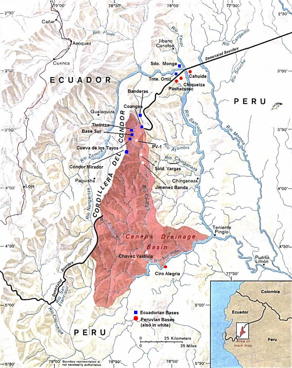
English: Peru-Ecuador (Area of Boundary Dispute). |
| 日期 | 未知日期 |
| 来源 | |
| 作者 | The University of Texas at Austin |
| 授权 (二次使用本文件) |
Stated as public domain. |
许可协议
原始上传日志
原始描述頁面位於這裡。下列使用者名稱均來自en.wikipedia。
- 2010-10-30 14:30 Beao 965×1216× (921862 bytes)
- 2009-10-01 21:16 Andres C. 1000×1292× (876675 bytes) A retouched image of a map located online at the University of Texas Library - PCL Map Collection website. Stated as public domain: http://www.lib.utexas.edu/maps/americas/peru_ecuador_81.jpg "Courtesy of the University of Texas Libraries, The Universit
文件历史
点击某个日期/时间查看对应时刻的文件。
| 日期/时间 | 缩略图 | 大小 | 用户 | 备注 | |
|---|---|---|---|---|---|
| 当前 | 2012年9月15日 (六) 05:31 | | 965 × 1,216(900 KB) | OgreBot | (BOT): Uploading old version of file from en.wikipedia; originally uploaded on 2010-10-30 14:30:35 by Beao |
| 2010年8月10日 (二) 14:47 |  | 1,000 × 1,292(856 KB) | File Upload Bot (Magnus Manske) | {{BotMoveToCommons|en.wikipedia|year={{subst:CURRENTYEAR}}|month={{subst:CURRENTMONTHNAME}}|day={{subst:CURRENTDAY}}}} {{Information |Description={{en|A retouched image of a map located online at the University of Texas Library - PCL Map Collection websi |
文件用途
以下页面使用本文件:
全域文件用途
以下其他wiki使用此文件:
- az.wikipedia.org上的用途
- ca.wikipedia.org上的用途
- de.wikipedia.org上的用途
- en.wikipedia.org上的用途
- es.wikipedia.org上的用途
- et.wikipedia.org上的用途
- fi.wikipedia.org上的用途
- he.wikipedia.org上的用途
- id.wikipedia.org上的用途
- it.wikipedia.org上的用途
- ka.wikipedia.org上的用途
- pt.wikipedia.org上的用途
- qu.wikipedia.org上的用途
- ru.wikipedia.org上的用途
- sv.wikipedia.org上的用途
- uk.wikipedia.org上的用途
- www.wikidata.org上的用途